One might think the Ohio River — 981 miles long and flowing through or bordering six states — is hard to miss, but that is exactly the problem the Central Ohio River Business Association (CORBA) deals with.
“It’s just there, it works, and people don’t realize it’s there,” said Erik Thomas, general manager at Benchmark River and Rail Terminals LLC and one of the organizers behind CORBA.
At this week’s Inland Marine Expo in St. Louis, advocates for inland river ports talked about their work promoting water transport options in their regions — not just to outside companies looking to relocate, but to established area businesses who for years may not have known of those opportunities.
“Folks just don’t have a clue how important the river really is,” Thomas said at a panel discussion “How to Raise Awareness and Increase Tonnage in Your Region.”
“We’re within a day’s drive of 60% of the U.S. population and 55% of the nation’s manufacturing,” Thomas said of his group’s designated area, some 200 miles that includes the ports of Cincinnati and northern Kentucky.
Without a clear identity, “there is no political entity to speak for the region,” he said. So after CORBA organized in late 2011, an early goal was to expand the Army Corps of Engineers’ monitoring of river traffic nearly ten-fold from the 26-mile confines of the “old port” around Cincinnati.
That “new port” designation showed 45 million tons of cargo in the first Corps data set issued in 2015, raising the profile of 19 Ohio and Kentucky counties to the 14th busiest port in the nation.
Now a freight analysis project is looking for cargo in the region that does not now move by water, and could be redirected to the river, Thomas said. Compared to a decade ago, there are now many more public information sources to assemble the kind of “big data” to enable such surveys, he added.
On the Missouri River, “what we found at our location is there were people 15 miles away who didn’t know what was here,” said Lucy Fletcher, who heads business development for AGRIServices of Brunswick LLC at mile marker 256 on the Missouri.
Fletcher, among the organizers of a Missouri River revitalization group, said about 30% of locks on the upper river are past their life expectancy, but added that the Brunswick terminal has experienced only one year in the past 39 when river conditions were unusable, and is a reliable cargo portal.
River operators can bring those messages to new audiences, starting with speaking before community groups like Rotary and Kiwanis clubs, Fletcher said.
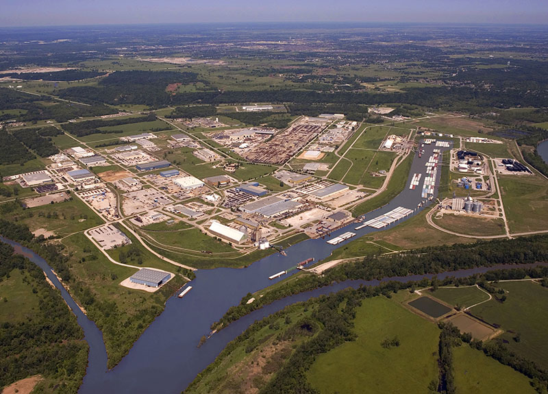
That is a priority for Oklahoma's Tulsa Port of Catoosa on the McClellan-Kerr Arkansas River Navigation System, where the Oklahoma Maritime Education Center runs a full-time public outreach program and tours of the port with its 70 co-located industries.
The waterway — 445 miles to the Mississippi River with 18 locks and dams — is still unknown to many in the region, said maritime education coordinator Sheila Shook. That makes it critical for river interests to work together.
“Technically aren’t we competition?” Shook said. “We don’t think about it that way … it’s all one system.”


.JPG.small.400x400.jpg)

