Every year during the spring thaw millions of cubic feet of water rush from the Upper Mississippi River and its tributaries down the waterway to New Orleans and eventually out into the Gulf of Mexico. This annual high-water event brings with it increases in the river’s current and can result in barge breakaways, collisions, allisions and, sometimes, loss of life.
The efforts of the Corps of Engineers, Coast Guard, and industry to keep these problems to a minimum is nothing short of monumental, though they get little credit from the general population.
This year nature has seen fit to get the river running high and fast early by dumping heavy rains in the Mississippi and Ohio river valleys, prompting the Corps in late January to send its East Coast trailing suction hopper dredge McFarland to New Orleans because shoaling on the Mississippi River at Southwest Pass was so bad. Meantime, the dredge Wheeler has been on site, spending most of its time in Southwest Pass.
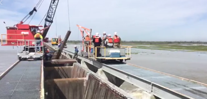
Additionally, on Feb. 27, the Corps decided to open the Bonnet Carré Spillway to ensure safe passage of the Mississippi through the greater New Orleans area. Operation of the structure, located about 33 river miles above New Orleans, is relieving pressure on main line levees, maintaining river stages, and regulating the flow downriver from the spillway.
That same day, a mast holding the flood and navigation lights of the 820'x144' tanker Clio, riding high, struck the Huey P. Long Bridge over the Mississippi River at New Orleans. Luckily, no one was injured, no fluids went into the water, the river was not closed and there was no damage to the bridge. That’s called dodging a bullet.
The Bonnet Carré Spillway is part of the multi-state Mississippi River and Tributaries (MR&T) system, which uses a number of features to provide flood risk reduction to the Mississippi Valley from Cape Girardeau, Mo., to Head of Passes, La. It can divert a portion of the river’s floodwaters via Lake Pontchartrain into the Gulf of Mexico, thus allowing high water to bypass New Orleans and other nearby river communities. The structure has a design capacity of 250,000 cfs, the equivalent of roughly 1,870,000 gps.
The river is expected to crest at 17' on March 13 and remain at that stage — because of the opening of the spillway — until March 23. Then it should begin to go down — until the spring thaw.


.JPG.small.400x400.jpg)

