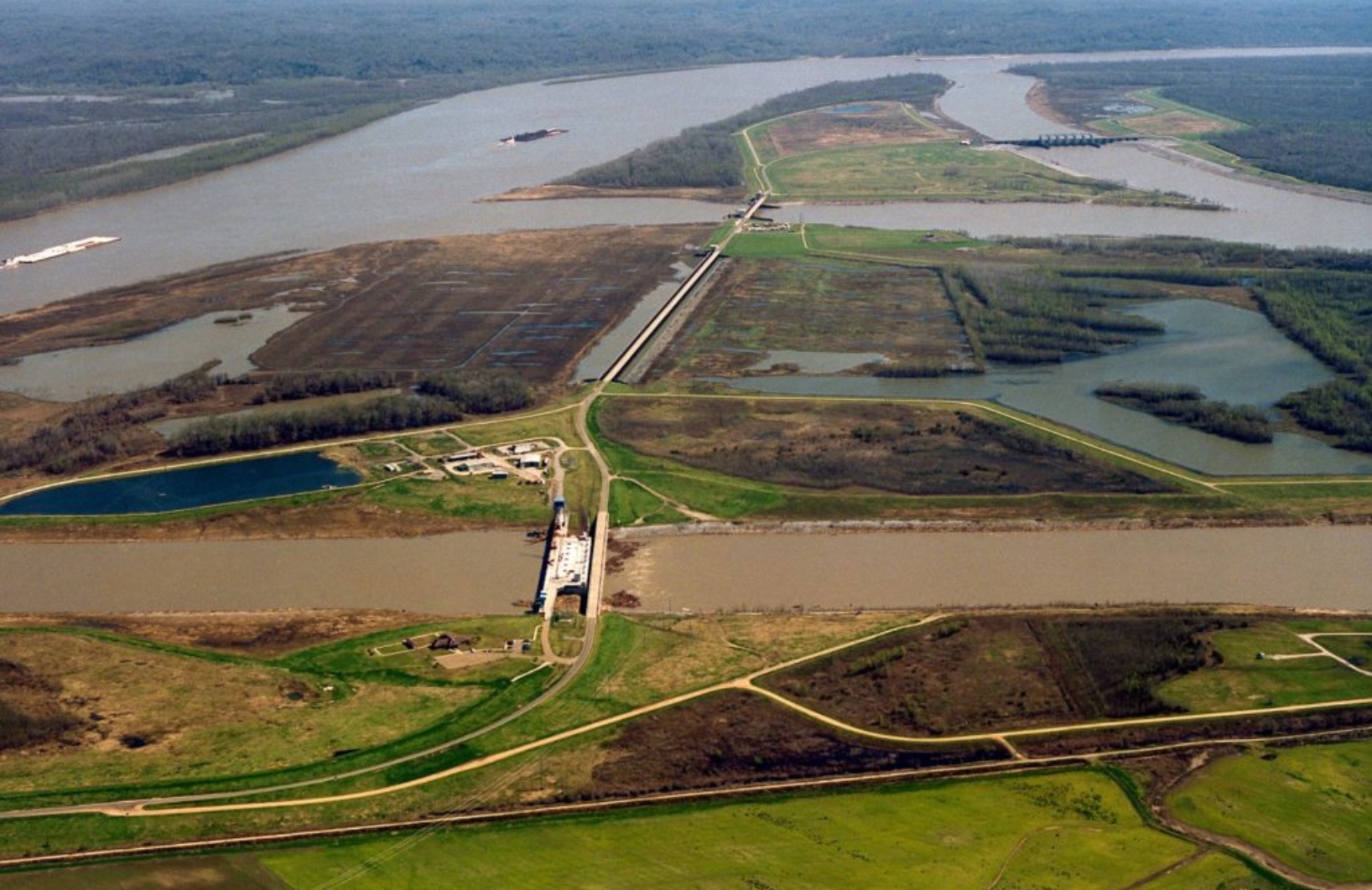
A buildup of sediment in the Lower Mississippi River could set the stage for a long-feared shift of the river into the Atchafalaya Basin, according to a study by a Louisiana State University research scientist.
Sediment deposited on the river bottom just south of the Old River Control Structure north of Baton Rouge, La., has reduced the river depth by about 30’ and narrowed the channel by half a mile since 1985, according to a presentation that hydrologist Yi-Jun Xu gave at the American Geophysical Union fall meeting in New Orleans in mid-December.
That has affected the river’s flow capacity in the reach below the Old River gates, built in stages by the Corps of Engineers starting in the 1960s to prevent a flood from shifting the Mississippi’s flow into the Atchafalaya.
The Corps and scientists have long understood the risk, seeing evidence the Mississippi has shifted course many times at intervals of around 1,000 to 1,500 years – with the area around Old River a previous point of departure for those shifts. The Atchafalaya would give the river flow a shorter and steeper route to the Gulf of Mexico, less than half of the 300 miles the Mississippi now flows from Old River.
The last flood to threaten the structures in 2011 attracted nerve-wracking news media coverage, with helicopter video shots of water boiling through the beleaguered controls.
The sediment buildup – estimated at some 36 million metric tons – increases the possibility that a future “mega flood” could overwhelm the structures, triggering a full capture of the flow by the Atchafalaya, with dire consequences for Louisiana’s people and economy, the study warns.
In addition to the bottom sediment, Xu identified some 530 million metric tons of sand on emerged river bars upstream between Old River and Vicksburg. If those were to be mobilized and swept downstream by a flood, they would impede the flow even more and potentially trigger the river to jump its bank around Old River.
Projections that river flow could increase by 11% to 60% by the year 2100, due to increasing precipitation and urban growth with more runoff, are another risk factor, Xu notes.
A breakout through the Atchafalaya would be catastrophic for Louisiana industry, which depends on the lower Mississippi for fresh water and would be stranded beside the old river channel, as it becomes essentially a tidal creek with salt water moving up from the Gulf of Mexico. That would create a public water supply crisis as well, immediately affecting around 1.5 million people in New Orleans and other communities that draw from the river, according to the study.
In the Atchafalaya Basin, such a flood would likely overwhelm Morgan City, La., and create new land in the basin, which has already seen significant silting up in the past 30 years, Xu wrote.
The paper recognizes one potential course of action – mining sediments for use in Louisiana’s massive coastal restoration enterprise – but cautions the risks and challenges are high.
“Sediment transport has been and will remain the biggest challenge for the management of this large alluvial river system,” Xu concludes. “There is a dilemma between the channel aggradation possessing avulsion risk and the high demand on sediment for coastal restoration. Conventional thinking and engineering practices may not have a solution here.
“A thorough assessment on trigger points and socioeconomic effects of a potential Mississippi River course switch is not only necessary, but inevitable (e.g., engineering solutions, risk assessment, emergency preparedness and response, and recovery capabilities).”


