A relatively warm October and expanding drought conditions across the Lower Mississippi Valley helped drop water levels to historic lows along parts of the Mississippi River last month, the National Oceanic and Atmospheric Administration (NOAA) said Wednesday in its latest U.S. climate report.
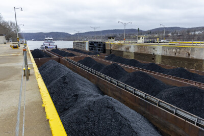
Warm temperatures and lack of rainfall resulted in the expansion of drought coverage and intensity across parts of the Mississippi Valley, leading to record-low water levels along parts of the Mississippi River for the second year in a row. The low water levels caused barges and ships to run aground during one of the busiest times of the year to ship grain and created saltwater intrusion concerns in southern Louisiana.
The U.S. also confirmed another billion-dollar disaster in October, bringing the total to a record 25 disasters in the first 10 months — the largest number of disasters for any year since NOAA has kept track of these types of events.
The average October temperature across the contiguous U.S. was 56.1°F, 2.0° above the 20th-century average, ranking as the 18th-warmest October in NOAA’s 129-year climate record.
One new billion-dollar weather and climate disaster was confirmed in October after severe thunderstorms brought damaging winds and large hail to parts of the southern Plains from Sept. 23 to Sept. 24.
Florida, Louisiana, Mississippi and Texas each ranked warmest on record for the year-to-date (YTD), while Connecticut, Maine, Maryland, Massachusetts, New Hampshire, New Jersey, Rhode Island and Vermont each ranked second warmest for the January–October period. No state experienced a top-10 coldest such YTD on record.
The U.S. precipitation total for the YTD was 25.50" — 0.14 of an inch above average — ranking in the middle third of the January-October climate record. Wyoming and Massachusetts ranked fourth wettest on record for this YTD while Connecticut, Maine, and Nevada each ranked fifth wettest. Meanwhile, Maryland logged its seventh-driest such YTD on record.


