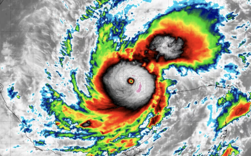
Hurricane Milton is headed toward landfall on the west coast of Florida in the early morning hours Thursday, after suddenly growing into one of the most intense cyclones ever seen in the Gulf of Mexico.
Widespread evacuation orders were issued in Florida coastal counties, ahead of the potential for devasting storm surges in what will be the state’s third major hurricane this season.
At. 2 p.m. Eastern time a NOAA and Air Force Reserve Hurricane Hunter air crew reported wind gusts in the storm approaching 175 mph, according to an update from the National Hurricane Center.
In it 5 p.m. update, the hurricane center upped its estimate of maximum sustained wind speeds to 180 mph, based on new satellite data. Forecasters also increased the possibility for storm surge in the Tampa Bay region to 10' to 15' above ground level.
Hurricane researchers at Colorado State University said Milton went “from tropical storm to category 5 hurricane in 24 hours.”
“Milton joins Michael as the only October Category 5 hurricanes in the Gulf of Mexico in the satellite era (1966-onwards),” Colorado State professor Phil Klozbach observed on social media. Since 1979 only Atlantic hurricanes Mitch in 1998 and Wilma in 2005 had lower pressures than the 911 millibars observed Monday, he said.
“Milton is a potentially catastrophic category 5 hurricane on the Saffir-Simpson Hurricane
Wind Scale,” according to NHC forecasters. “While fluctuations in intensity are expected, Milton is forecast to remain an extremely dangerous hurricane through landfall in Florida.”
At category 5 windspeeds can be catastrophic even for structures built to modern hurricane construction codes. Milton could weaken slightly to category 3 as it approaches the Florida coast but also expand its wind field over a wider area.
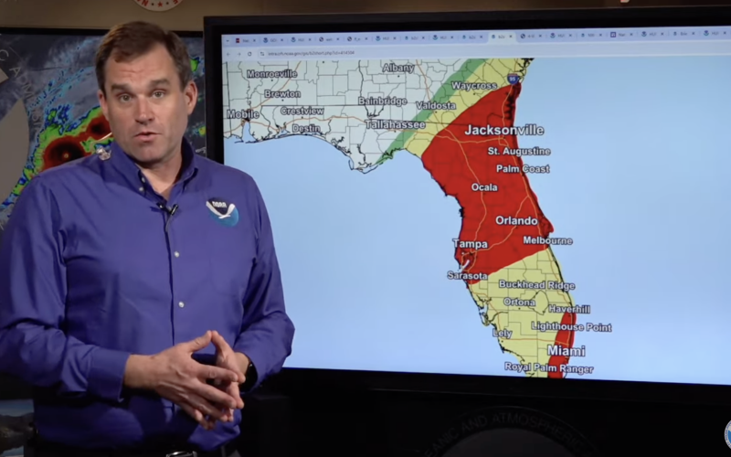
Hurricane center track projections showed the path through Thursday, crossing west to east over the Florida and likely emerging into the Atlantic around 1 p.m. In a Monday morning video briefing National Hurricane Center Director Michael Brennan urged viewers in coastal areas to heed evacuation orders – and to prepare for hurricane-force wind impacts extending far inland.
The Coast Guard reestablished its emergency operations center at its Air Station Miami at Opa Locka, Fla., less than two weeks after the airfield mobilized to respond to hurricane Helene’s Sept. 26 landfall on Florida’s Big Bend coast.
In roughly the center of Milton’s potential track, the Tampa Bay region could be in danger of storm surges 10’ to 15’ high, according to the hurricane center.


