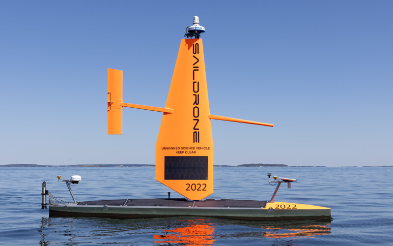
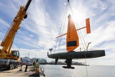
Saildrone will provide autonomous sea surface vehicles to cruise Florida Gulf of Mexico waters, contributing to the state Florida Seafloor Mapping Initiative (FSMI), to help build “accessible, high-quality, and high-resolution seafloor data of Florida’s coastal waters within the continental shelf,” the company said.
Based in Alameda, Calif., Saildrone has its ocean mapping headquarters in St. Petersburg, Fla., and will deploy its uncrewed survace vehicles (USVs) from there. The company’s long-endurance USVs have played roles in siimilar research, from hurricane studies to fisheries related surveys in the Gulf of Maine.
“Updated mapping data of coastal systems is critical for protecting offshore infrastructure, habitat mapping, restoration projects, emergency response, coastal resilience, and hazard studies for the state’s citizens,” according to a company statement.
The $1.66 million mission will focus on the Florida Middle Grounds, a relict coral-reef area of hard bottom in the northeast gulf around 80 miles northwest of St. Petersburg, to map about 1,750 square miles using two 33’ Saildrone Voyager vehicles.
The Voyagers are equipped with NORBIT WINGHEAD i80s echo sounders for high-resolution mapping, and radar, AIS, and cameras for maritime domain awareness.
At 1,350 miles long, Florida’s coastline is the longest in the Lower 48 states, second only to Alaska. “Many parts of the Florida coast remain unsurveyed, with existing nautical charts relying on outdated and low-resolution data,” according to Saildrone.
Data from the Saildrone survey will help research into Florida’s coastal vulnerability and hurricane risks, evaluate the performance of coastal restoration projects, and support ongoing resilience efforts and flood risk mapping.
“Mapping the Florida coastline is vital for understanding our dynamic coastal environments, supporting sustainable resource management, and enhancing resilience against extreme weather events. FSMI will provide critical insights that empower policymakers, researchers, and local communities to protect vital ecosystems and infrastructure along Florida’s coasts,” said Brian Connon, Saildrone’s vice president of ocean mapping.
The seafloor mapping initiative will build on the Florida Coastal Mapping Program (FCMaP), an initiative led by federal and Florida state agencies and other community stakeholders to generate a comprehensive high-resolution seafloor data set of Florida’s coastal waters by 2028.
As it’s developed, the new data “will be available for immediate use to update navigational charts and identify navigation hazards, provide fundamental baseline data for scientific research, and provide information for use by emergency managers and responders,” according to Saildrone.


